Ellis
Every street holds a story if you know where to look.
Client
Concept
Type
• Product Strategy • User Research • UX Design • UI Design • Interaction Design • Design System • Prototyping
Scope
• Product Design • UX/UI Designer • UX Researcher
Website
Brasília, Brazil
Executive Overview
ELLIS is a mobile travel experience designed to help independent travelers discover the hidden stories, historical details, and overlooked places they would otherwise walk past.
Instead of replacing the destinations already on a traveler's itinerary, ELLIS makes the journey between them part of the experience.
Meet ELLIS
Travelers already know where they want to go. ELLIS helps them discover what they didn't know to look for.
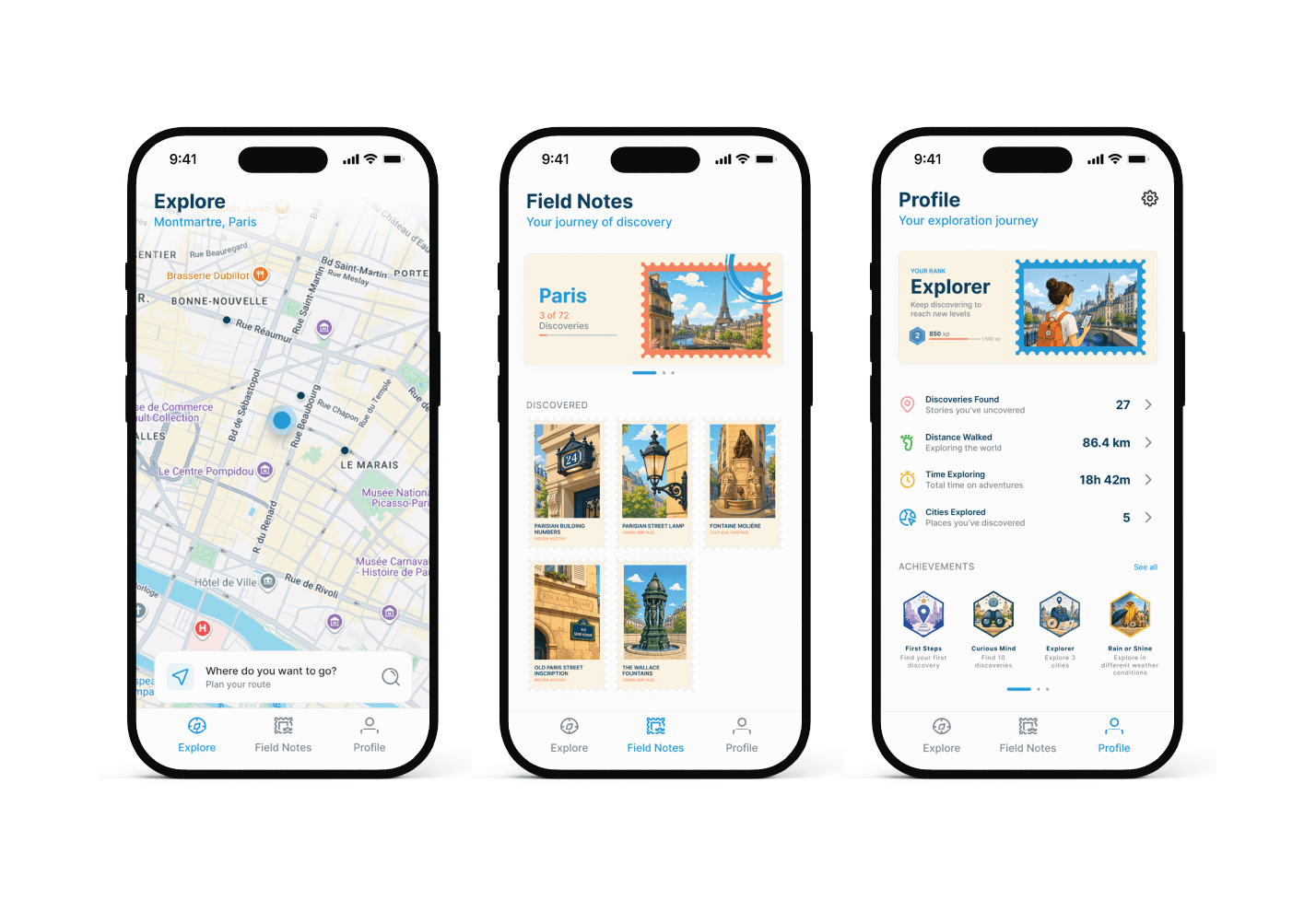
Explore
Discover what's around you.
Navigate to your destination while uncovering stories hidden along the way.
Field Notes
Collect what you've discovered.
Every discovery becomes part of a visual collection organized by the cities you've explored.
Profile
See where curiosity has taken you.
Track your discoveries, distance, cities, achievements, and progress as an explorer.
The Idea
The idea for ELLIS came from a frustration I experienced repeatedly while traveling.
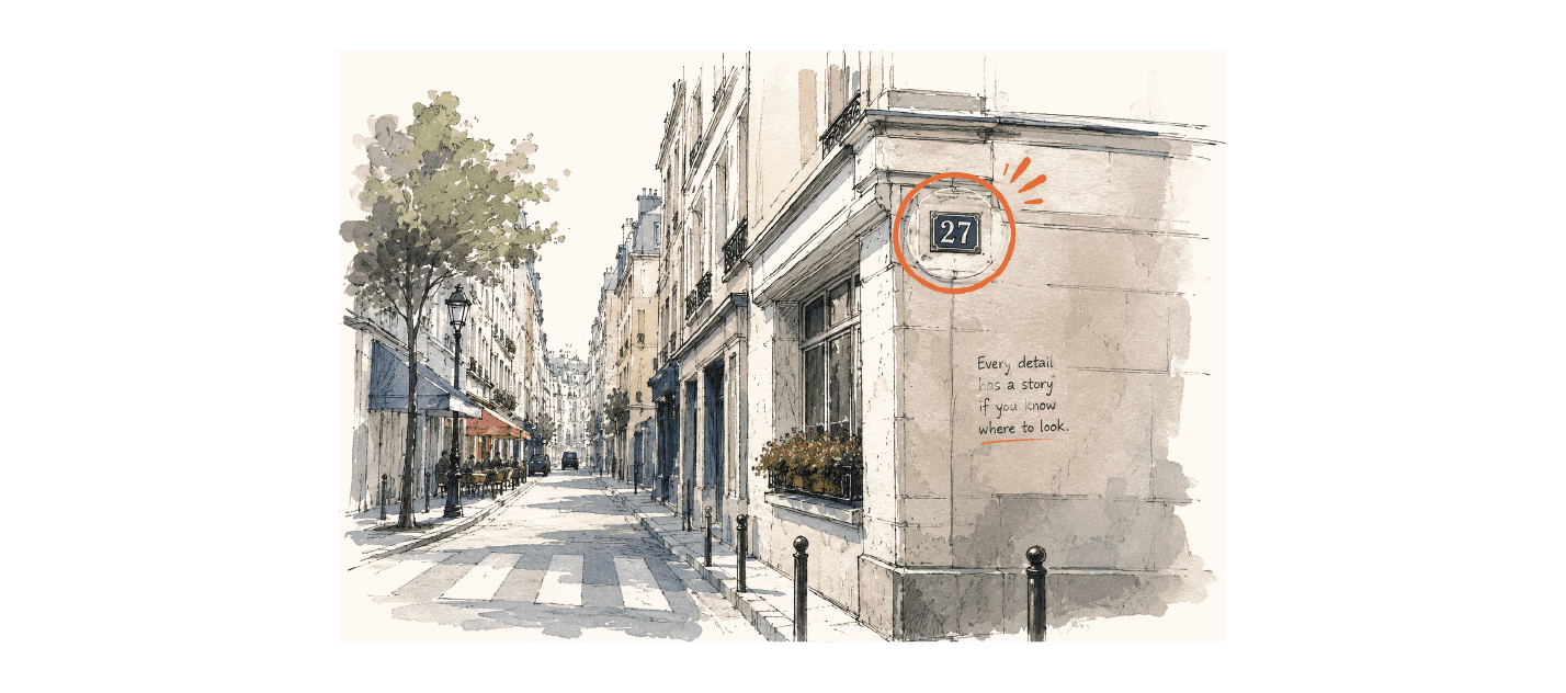
I would return home, read about the places I had visited and realize that I had walked directly past something fascinating without knowing it was there. Sometimes it wasn't a famous landmark. It could be a fountain. An inscription on a wall. A building number. An architectural detail. Something completely ordinary at first glance, but connected to a story I would have loved to know while I was standing there.
That led to a simple question:
What if your phone could tell you when there was a story worth discovering nearby?
The Problem
Travel planning naturally revolves around known destinations.
We search for landmarks, save attractions and use navigation apps to move efficiently between them.
But cities aren't made only of destinations.
There is an entire layer of history between Point A and Point B.
Discovering that layer often requires previous knowledge, extensive research or a local guide. ELLIS explores how those stories could become contextual, spontaneous and accessible while walking through a city.
Research
I didn't want to design ELLIS around my own travel habits alone. I conducted a survey with approximately 100 participants, using 11 questions to understand how people plan trips, navigate unfamiliar cities and discover places while traveling.
Participants could volunteer for further research, leading to approximately 12 open-ended interviews that helped me understand the motivations behind their answers.
One behavior stood out.
Google Maps was already part of almost everything.
Participants relied heavily on it to search for places, navigate, understand distances and decide where to go next. That insight became fundamental to the ELLIS experience. Travelers didn't need another unfamiliar navigation system.
They needed something that could build on a behavior they already understood and introduce a layer that traditional navigation doesn't provide.
The opportunity wasn't helping travelers find what they already knew. It was helping them discover what they didn't know to search for.
Understand the Traveler

Victoria, 35
Marketing Coordinator
Victoria works remotely, travels frequently and prefers exploring independently rather than relying on guided tours. She enjoys planning ahead but doesn't want research to consume the experience itself.
Goals
Explore cities independently.
Make better use of her travel time.
Understand places beyond their most famous attractions.
Discover things she couldn't have planned for.
Frustrations
Travel planning can become time-consuming.
Interesting places are often discovered only after returning home.
Recommendations tend to concentrate on the same attractions.
Useful information is fragmented across multiple platforms.
Looking at the Landscape
I analyzed tools travelers already use for planning, navigation and discovery.
Google Maps excels at navigation and search.
Tripadvisor provides attractions, reviews and recommendations.
Wanderlog supports itinerary planning and route organization.
ELLIS wasn't designed to replace any of them.
The opportunity was between navigation and discovery.

From Research to Product
I structured the project using the Double Diamond framework.
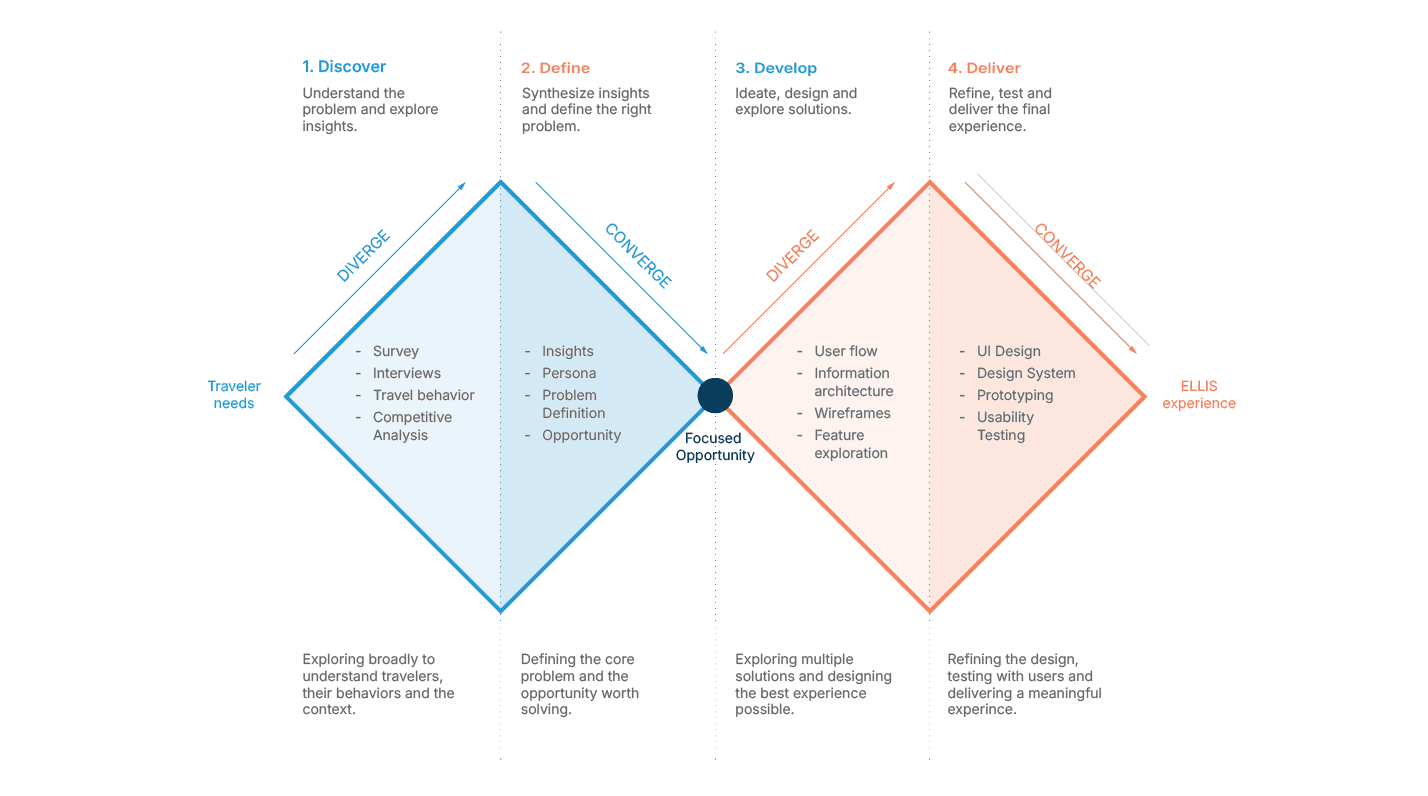
Discover
Survey · Interviews · Travel behavior · Competitive research
Define
Insights · Persona · Problem definition · Product opportunity
Develop
User flows · Information architecture · Wireframes · Feature exploration
Deliver
High-fidelity UI · Design system · Prototype · Final experience
The process wasn't entirely linear. As the product became more tangible, several ideas evolved — particularly route planning, Field Notes and Profile.
The Product Vision
ELLIS transforms walking through a city into an ongoing experience of discovery.
Rather than asking travelers to constantly search for information, the product quietly accompanies them and surfaces stories when they become relevant.
The phone shouldn't become the trip. The city should remain the experience.
How ELLIS Works
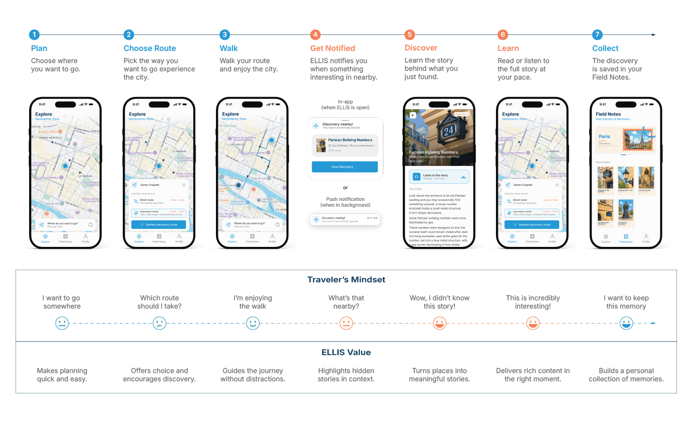
Plan → Walk → Get Notified → Discover → Learn → Collect
Choose where you want to go. Walk normally through the city. ELLIS watches for relevant stories nearby.
Enter a Discovery radius. Learn what makes that place special. Keep the story in your Field Notes. And continue exploring.
Familiar Navigation. A Different Purpose.
Explore
Explore is the heart of ELLIS and the screen travelers are expected to spend the most time using.
Because research showed how strongly travelers already rely on Google Maps, I deliberately built upon a familiar navigation model instead of asking users to learn a new one. The map remains the primary canvas.
ELLIS adds discovery on top of it. The interface always keeps the traveler grounded in their current location, while a persistent search component provides access to route planning.
Smart Destination Search
Where do you want to go?
Plan your route
When search is activated, ELLIS doesn't present only an empty input. It understands the city the traveler is currently exploring and suggests relevant destinations. In Paris, for example:
Sainte-Chapelle
Eiffel Tower
Arc de Triomphe
Louvre Museum
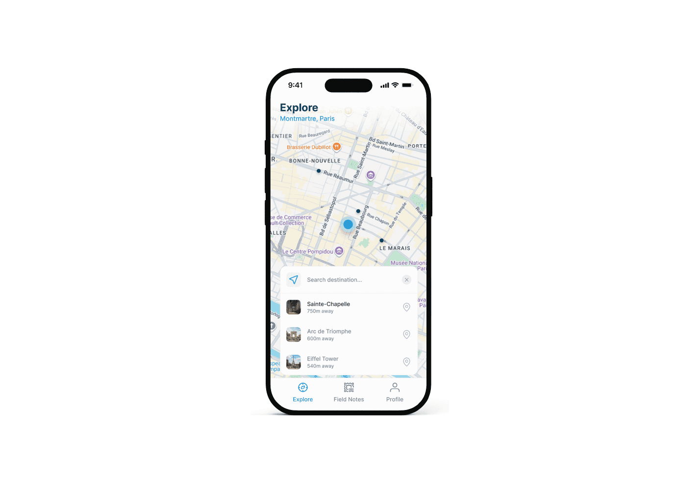
These suggestions reduce friction around destinations travelers are likely to search for while still allowing them to choose anywhere they want.
Two Routes. Two Ways to Experience the City.
Once a destination is selected, ELLIS presents two possibilities.
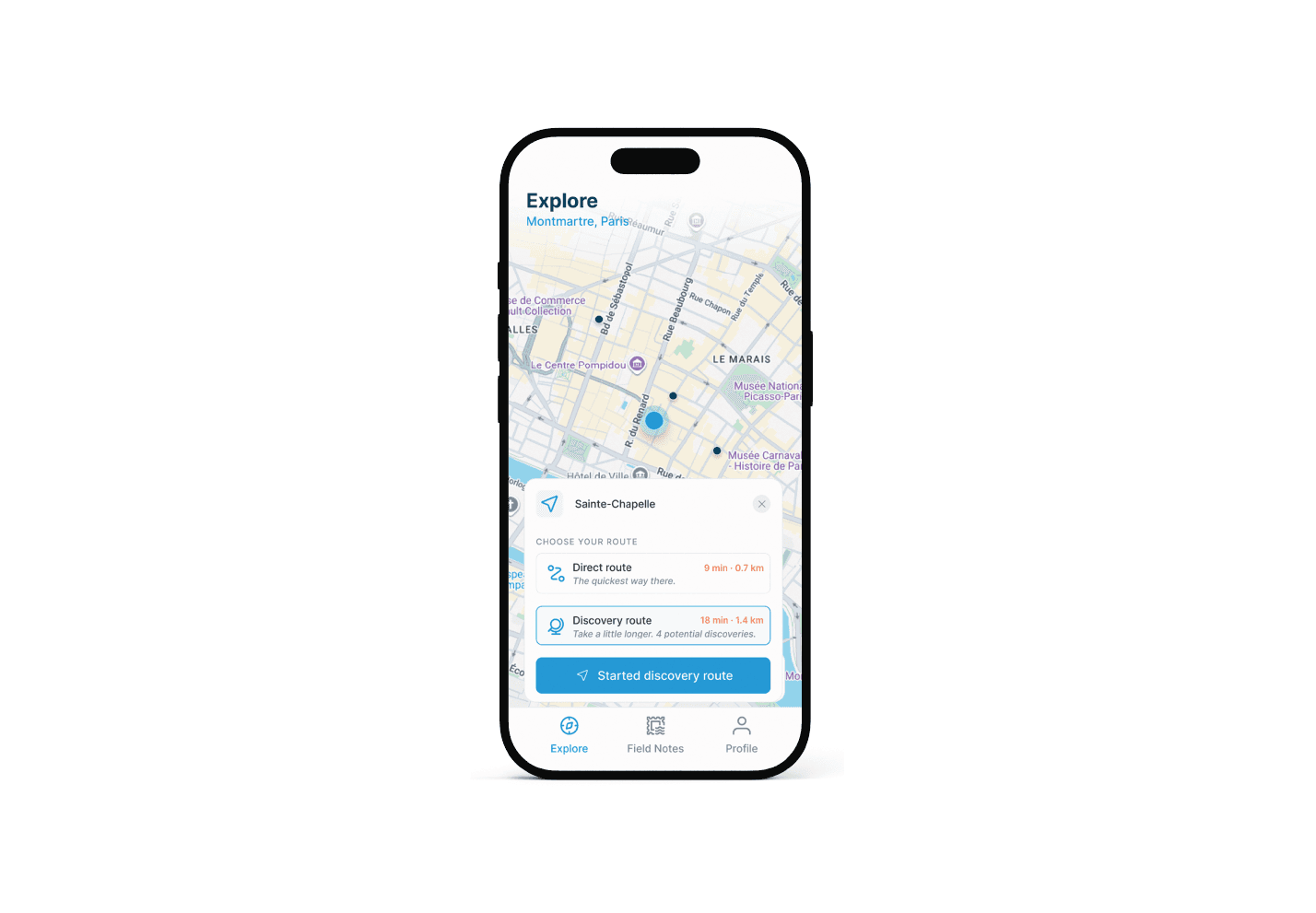
Direct Route
The quickest way there: Designed to reach the destination efficiently. Discoveries can still happen naturally along the way.
Discovery Route
Take a little longer. Discover more along the way: An intelligently generated route that may add some walking time in exchange for more potential Discoveries.
Direct Route: 18 min · 1.3 km.
Discovery Route: 24 min · 1.7 km – 4 potential discoveries.
The goal isn't to make travelers take the longest route. It's to show that sometimes a few extra minutes can completely change what they experience along the way.
Discovery Happens Before You Know What You're Looking For
ELLIS doesn't wait for the traveler to stand on an exact GPS coordinate. Each Discovery operates within a proximity radius. GPS positioning can vary, particularly around dense urban environments. Triggering only at an exact coordinate could mean notifying someone after they have already passed the point of interest.
Instead, ELLIS alerts the traveler as they approach.
Discovery nearby!
You found something special.
Parisian Building Numbers
200 m away
View Discovery
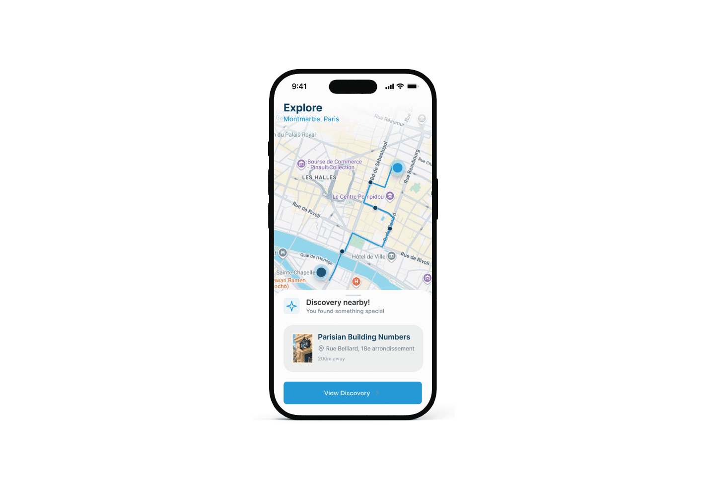
When the app is open, the notification appears as a bottom sheet. When ELLIS is in the background or the phone is locked, a push notification takes its place.
The traveler doesn't need to keep staring at the screen. ELLIS can stay quiet until there's something worth noticing.
From Place to Story
Discovery Detail
Selecting View Discovery opens a storytelling experience dedicated to what the traveler has just found.
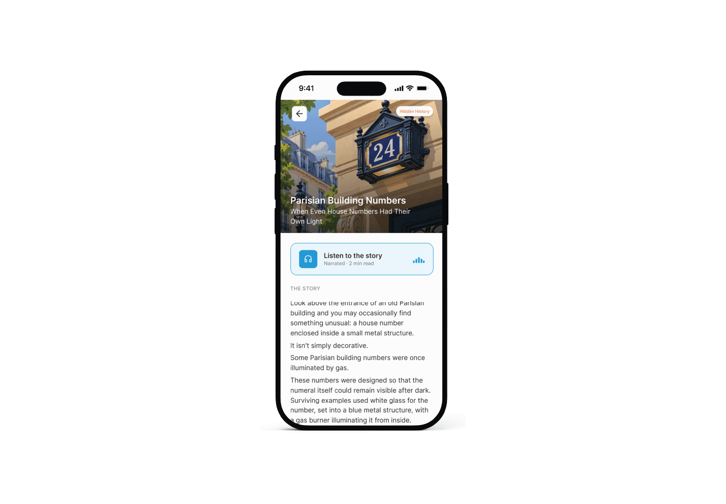
Parisian Building Numbers
When Even House Numbers Had Their Own Light
Every Discovery follows a consistent structure while allowing the story itself to determine its length. A large ELLIS illustration introduces the subject, while real photographs throughout the content provide documentary context.
Read It Now. Or Keep Walking.
Travel doesn't always provide the perfect moment to stop and read. So every Discovery also supports audio.
Listen to the story
Narrated · 2 min read
The traveler can:
Read the story immediately.
Listen while continuing to walk.
Return to it later through Field Notes.
The interface adapts to the journey rather than asking the journey to adapt to the interface.
Stories That Change the Way You Look at a City
ELLIS isn't designed to deliver trivia. The goal is to provide enough historical context for an ordinary object or place to become meaningful. A Discovery might reveal why Parisian building numbers once had their own lighting system.
Another might explain how the Wallace Fountains began as an act of philanthropy.
Another might reveal an old street name still carved into a building.
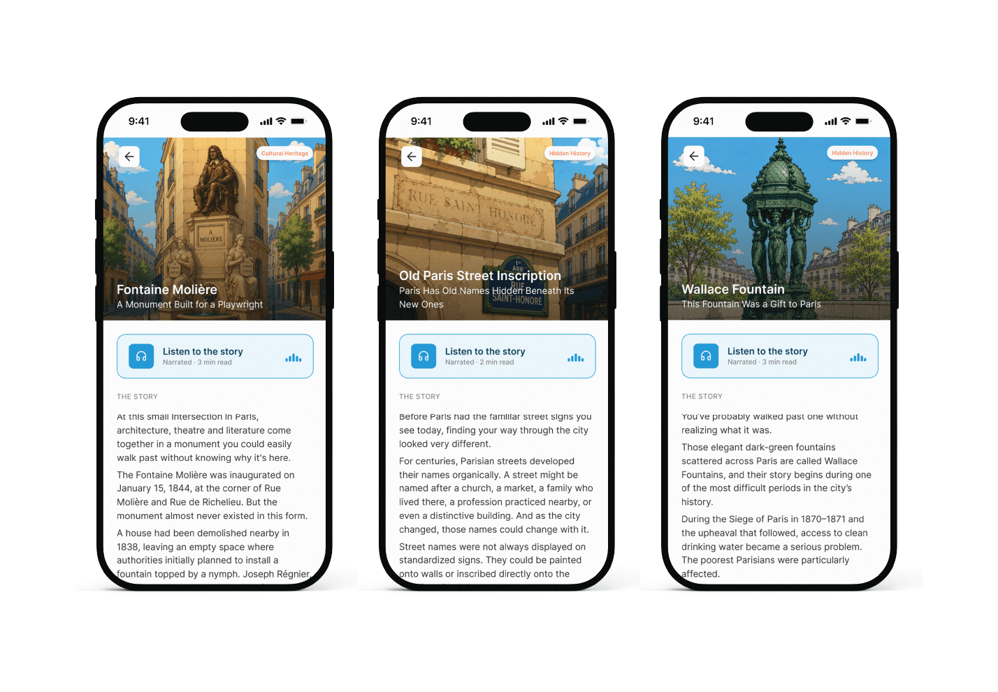
Every story ends with a short ELLIS reflection — a final thought intended to make the traveler look at their surroundings differently.
Sometimes history isn't inside the building. It's the number above the door.
Turning Discoveries Into Memories
Field Notes
Your Journey of Discovery
Finding something is only part of the experience.
I wanted Discoveries to feel like things travelers had collected through experience, rather than another list of saved locations. That idea became Field Notes.
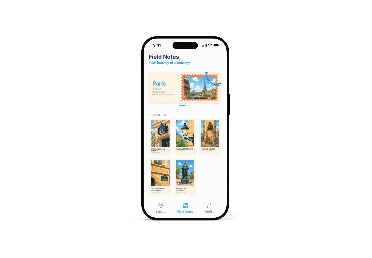
Each city the traveler has explored becomes part of a horizontal carousel.
Paris
3 of 72 Discoveries
Swipe:
Paris → London → Rome
Changing the city changes both the progress and the collection underneath.
A Collection Worth Building
Instead of conventional cards, every discovered story becomes a postage stamp.
Each stamp combines:
A unique illustration
The Discovery name
And his category
The postage-stamp language connects Field Notes to the idea of travel, collecting and memory. Selecting a stamp reopens the complete story. Field Notes becomes a visual record of everywhere curiosity has taken you.
Your Exploration Journey
Profile
While Field Notes represents what the traveler has found, Profile represents how their journey has evolved.
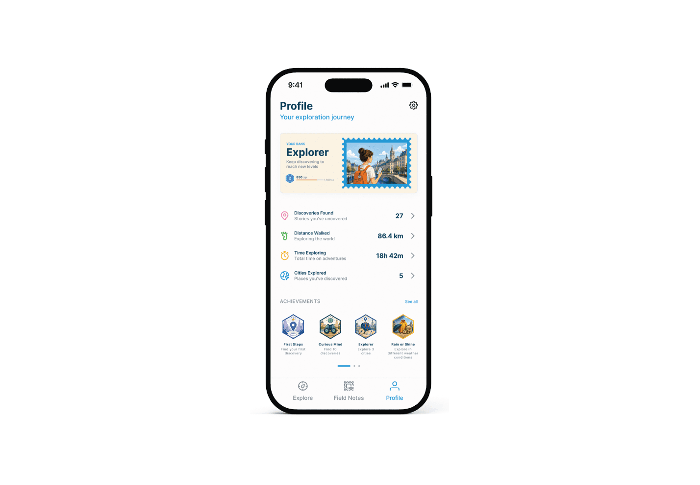
The experience introduces a light layer of progression without turning exploration into a game.
Growing as an Explorer
Your rank
Explorer
Keep discovering to reach new levels.
Level 2
850 XP / 1,500 XP
Exploring, walking and discovering contribute toward progression.
As travelers gain experience, their Level and Rank can evolve and even the illustration inside the Rank Card can change to represent their new stage. The intention isn't to make points the reason to explore.
Progress simply celebrates the exploration already happening.
The Journey in Numbers
Profile also provides a snapshot of the traveler's accumulated exploration.
Each statistic can become an entry point into deeper information, such as discoveries by city, walking history or routes completed over time.
The overview stays simple. The detail is available when the traveler wants it.
Achievements
Achievements introduce another playful way of recognizing exploration.
Rather than rewarding arbitrary app interactions, achievements are tied to behaviors ELLIS wants to encourage: Walk more. Look closer. Explore differently. Stay curious.
Three Spaces. Three Moments.
The final architecture deliberately contains only three primary destinations.
Explore: Where you discover.
Field Notes: What you've discovered.
Profile: Who you're becoming as an explorer.
This keeps the product focused while giving each area a distinct purpose.
Building the Visual Language
Travel is associated with curiosity, anticipation, happiness and memory. I wanted ELLIS to carry some of that feeling. The visual system therefore uses a restrained but optimistic palette, expressive illustrations and a clean interface that allows the content and the city itself to remain central.
Color
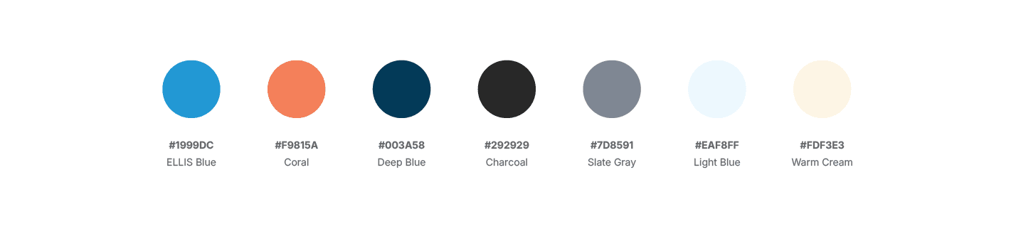
Bright colors provide personality and energy, while deeper blues and neutrals maintain hierarchy and readability.
Typography
Inter
I chose Inter as the primary typeface for its clarity, versatility and readability across interface sizes.
40/44 · Bold: Onboarding Display
26/30 · Bold: Screen Titles
22/28 · Semibold: Discovery Titles
18/24 · Semibold: Section Titles
16/24 · Regular: Body
14/20 · Medium: UI Content
12/16 · Medium: Eyebrows & Supporting Information
The typography remains deliberately neutral, allowing ELLIS's illustrations, stories and colors to carry more of the personality.
Layout & Components
ELLIS was designed for an iPhone 16 frame at 393 × 852 px, using an 8-point spacing system as the foundation for layout consistency. As the product evolved, recurring interface patterns became reusable components.
Selected and active states use consistent changes in color, border and background rather than introducing new interaction patterns for every screen.
An Illustration System Built Around Discovery
Illustration became an important part of ELLIS's identity. The same visual language extends across:
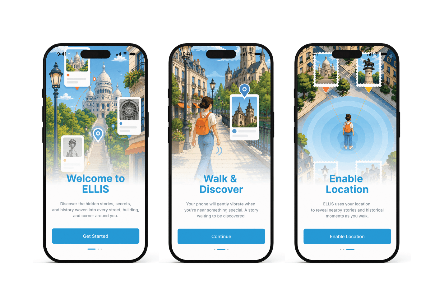
Onboarding
Cities
Discoveries
Field Notes
Rank progression
Achievements
They represent the same subject from different compositions rather than simply cropping one image into another. This allows the illustration system to remain consistent while adapting naturally to different interface contexts.
What I Learned
ELLIS began as an idea about showing travelers interesting places nearby.
As the project evolved, I realized the strongest version of the product wasn't the one with the most travel features. It was the one with the clearest purpose. ELLIS doesn't need to replace Google Maps. It doesn't need to replace Tripadvisor. And it doesn't need to plan every moment of a trip.
Its value lies in helping travelers notice the stories they would otherwise walk past. That clarity shaped the final product from familiar map interactions and proximity notifications to Discovery Routes, storytelling and Field Notes.
Looking Ahead
The current ELLIS experience focuses primarily on individual exploration. But travel is also something people love to share. There are several directions in which the product could evolve.
Community & Shared Routes
Travelers could create and share their own Discovery Routes.
Someone might create:
Hidden Paris Architecture
A Walk Through Roman History
London Beyond the Landmarks
A Day of Museums
Friends could share routes directly with each other, while a broader ELLIS community could surface unconventional ways of experiencing familiar cities. The goal wouldn't be to turn ELLIS into another social network. It would be to let one person's curiosity become another person's journey.
Explore First. Sign Up Later.
ELLIS would avoid forcing travelers to create an account before experiencing the product.
A first-time user could:
Open ELLIS → Complete Onboarding → Enable Location → Start Exploring
No registration wall. Only after experiencing the product would ELLIS encourage account creation.
A free account would permanently preserve and synchronize:
Discoveries
Field Notes
XP
Rank
Achievements
Statistics
Travel history
Instead of:
Create an account to continue.
The proposition becomes:
You've created something worth keeping.
A Premium Model Without Selling the Discovery
A future premium tier could reveal where Discovery opportunities exist on the map. But not what they are.
Premium travelers could use those locations to plan their walks, but the story itself would remain locked until they physically reached the area and entered its proximity radius. Paying reveals where to explore, not what you'll discover.
The user still has to walk. Still has to reach the place. Still has to discover it.
ELLIS can reveal the path. The discovery still has to be earned.
Every Street Holds a Story
ELLIS started with a simple frustration:
How many stories do we walk past without ever knowing they're there?
A fountain can become an act of generosity. A number above a doorway can reveal how a city once organized itself. A faded inscription can expose a version of a street that no longer officially exists.
ELLIS doesn't change where travelers want to go. It changes what they notice along the way.
Every street holds a story if you know where to look.
ELLIS helps you find it.
RECENT WORKS